To City Councilmembers and Concerned Santa Monica Residents
Budget Item: Study of a half-light at 1440 Beach Lot Exit.
It was with some disbelief, shock, and astonishment that came from a group of residents watching the replay of the final night of budget discussions and approval that a $200,000 expenditure item was so easily passed with minimal amount of discussion and devoid of facts (it was alluded that the city has some information but it was not presented nor has it been made public).
The exchange between Council Member Holbrook (who was correct in stating that most of time there is not a problem) and the Police Officer was horrific as the city employee lacked the knowledge of the area, misspoke about resident views, incorrectly stated the traffic flow, and basically stated an unqualified opinion stating there was a very serious problem – and then the item later passed.
There are some basic facts that were never presented or were not correctly stated at anytime during the discussion of this budget item.
To Start
1. There has never been a city – resident meeting on the subject of a light at the exit for those living north of the 1440 lot. If held the city would find an over whelming majority that are against a light at this location as it would significantly impact the traffic flow causing problems for residents to leave their homes.
2. The amount of time a light would even be needed (based on 365 days x 24 hours) was never discussed. If there is even 40 days (13 summer weekends + 14 other random days) in the year you would really need a light, there would only be a need for a few hours each of those days – at the most you may need 120-150 hours annually for a light or a parking enforcement officer to help – that means you need a light at best 2% of the time each year at this exit. I don’t think the money is worth it for such a minimal need and where there is an alternative.
3. The Police themselves cause some of the problems and contribute to the congestion on those high-end use days by the pattern and method they use in putting cones out and blocking off the connector between PCH and Appian Way and at times the PCH ramp (Moomat Ahiko Way). A review of these traffic control methods might find that a more active monitoring of the traffic might mitigate some of the negative effects.
4. Poor driving habits – we know the city can not train drivers, but too many drivers wait until all three lanes are clear before pulling out. If drivers simply pulled out into the near lane when cleared and merged into the middle lane maybe up to half the exiting traffic back-up would be cleared up. The historic alternative of exiting on Appian Way would relive those drivers who do not want to exit on a highway/freeway.
I think there also should have been some historical perspective provided on this area to understand what has worked in the past and what has contributed to what is the current perceived problem.
The 1550 Parking Lot (also known as Lot 1 North) was developed in the 1950’s and the historic Entrance and Exit was via Appian Way and the ramp between the street and the lot.
The 1440 Parking Lot (also known as Lot 2 North) was developed before the 1950’s and has had numerous configurations as this was the site of a number of public and private beach clubs that have come and gone, and then later created as only a parking lot. The historical entrance and exit for most of the time had been PCH (Palisades Beach Road). The entrance from PCH was later closed leaving the entrance as only via the 1550 lot.
With the demise and demolition of the Deauville Club (situated between the 1550 and 1440 lot) in the early 1970’s the 1550 lot was expanded and a connection between the 1550 and 1440 lot was established (requires the crossing of Ocean Front Walk). For 30 years there were two exits for both of the lots one via Appian Way and the other via PCH.
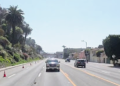
Then in 1999, the south bound lane from PCH to Appian Way was blocked off functionally closing it to most traffic while the City was constructing the water treatment plant near the Pier. That closure was to last for the duration of construction. But when the plant was completed in 2002, Appian Way was not restored to the 2-way road it had always been for more than 70 years. Instead, the ‘temporary” dead end, just north of the pier was maintained, and cars were diverted into the 1550 beach parking lot
Point of fact here is that it took a city ordinance (in a public form) to close the northbound lane of Appian Way connecting to PCH in the 1950’s. 50 years later when the city government is suppose to be more transparent there was 1. No Resident outreach or forum for those living north on PCH and those living in Ocean Park (these are the two groups of residents most affected by the close), 2. There was no City Ordinance or public form to discuss the closing, and 3. There was no traffic study done to determine if there would be any negative effect to the continue closing of the southbound lane.
For more information on the closing, please reading the following article – a year after the closing. smmirror.com/volum5/issue19/no_free.asp.
For the few or the one resident that is vocal about keeping the street close, one must again look at the historical point that the number of residents on Appian Way has been significantly reduced over time. Appian Way has become more of a back alley for the hotels that were developed on the street than the front door of residents. In other words the number of residents that would feel inconvenient (even though for 70 years it was never a problem) to the re opening is far fewer than in the past, and would restore a convenience that was used by thousands of local residents, and provide another path to pushing traffic to park in the underused south parking lots.
In addition to the closing of the southbound lane of Appian Way, the city re striped the intersection at the top of the PCH Ramp (now known as Moomat Ahiko Way) at Ocean Avenue from two right (southbound) turn lanes and one left (northbound) to only one right and two left turn lanes (there never is enough traffic turning left to justify two dedicated lanes). The effect of this change has been to create numerous backups with cars backed up as far south as the homes on Palisades Beach Road and effectively blocking the 1440 Lot exit on busy days.
These historical notes are presented for you to understand that prior to the closing of the southbound land of Appian Way and the restriping of the Ocean Ave/PCH Ramp that there was never a concern or perceived problem of those exiting the 1550/1440 beach lots. In other words we have a no cost alternative to resolving the perceived problem.
I think that in this time of economic instability that the smart and prudent role of government before rubber stamping a $200,000 expenditure is to explore low cost or prior historical alternatives that will correct/relive a problem. In many ways prior city staff decisions and actions have had the cumulative effect that has lead us to a minor problem that really does not require or justify this amount of expenditure when there are plenty of other major problems in the city that has required rising taxes and increasing service fees.
Several resident association and organizations have endorsed the plan of reopening Appian Way and the re stripping of the intersection and have sent this request as part of the EIR comments for both he Incline and Bluff projects.
I think at this time the city should stop, listen, do the most for the most residents, and save $200,000.
David Newberg
Palisades Beach Road Resident
Reprinted by permission of Friends of Sunset Park (FOSP).
June 19, 2008
City Council
1685 Main Street
Santa Monica, CA 90401
RE: Urban Forest
Dear Mayor Katz and Honorable Council members,
Trees can have a huge impact on the quality of life in a city. Although Santa Monica has a comprehensive urban forestry program, and prides itself on its program, we believe that we can do an even better job. Although a number of residential streets in Sunset Park are lined with large, mature ficus trees that were planted in the 1960s (meeting over the streets to create what some children refer to as the “tree tunnels”), many of our other street trees remain small both in height and canopy, even when they grow to maturity.
The latest Sustainable City Progress Report (11/07) rates the percentage of canopy cover in Sunset Park at 30 percent whereas, for comparison’s sake, portions of North of Montana rate as high as 75 percent.
On our 2005 FOSP neighborhood questionnaire, we asked whether residents favored replacement trees with larger canopies. The response overwhelmingly (72 percent) favored such a change to our urban forestry design.
Although a more ambitious street tree/larger canopy program will be more costly, we believe that the environmental and aesthetic benefits will far outweigh the additional costs. Benefits include shade and protection from the sun, absorption of CO2, oxygen production through photosynthesis, filtration of polluted air and water, retention of storm water runoff, providing wildlife habitat, reduction of the heat island effect, the beauty of a street tree canopy, and increased property values.
An enhanced street tree program should include:
Making the maximization of each tree’s canopy a primary objective of the street tree program.
Reexamining tree selection in the street tree plan, both species and the size of specimens planted, as well as size of canopy at maturation.
Making removal of trees a last resort.
Establishing regular ongoing community education programs regarding our urban forest, emphasizing street tree care and maintenance.
Reexamining our policies for root pruning and sidewalk maintenance with an eye to minimizing, if not eliminating, harmful root pruning.
Considering expansion of parkway widths to preserve existing trees and to allow planting of larger trees.
We believe that in order to achieve these goals the community needs greater participation in policy-making and decision-making, as well as oversight of our urban forest. To that end we strongly believe that a Tree Commission or similar body is necessary.
We believe Santa Monica should set as a high priority goal having the best urban forest, having the largest tree canopy, and having the premier street tree program in California.
Respectfully,
Board of Directors, Friends of Sunset Park
* * * *
TREESAVERS UPDATE
Courtesy of Jerry Rubin
I spoke with Santa Monica civil engineer Greg deVinck a few days ago and he told me the seven ficus trees along the east side of Fourth Street between Broadway and Wilshire that are planned by the City for uprooting and relocation will not take place in June and also not likely in July. That means Treesavers can still attempt to convince City Councilmembers and the City Manager to not unnecessarily relocate these beautiful, environmentally- friendly and healthy mature ficus trees simply for design and aesthetic purposes. Independent certified arborists have said the trees would not survive – certainly not for long – this relocation plan. Treesavers and so many others in our community are asking the City to instead put the money – well over ten thousand dollars for each tree relocation- into planting many, many more new trees in tree-sparse areas throughout the City.
Please start calling and e-mailing today. Ask others also.
Santa Monica City Councilmembers:
310.458.8201
One phone message will be sent to all.
E-mail: council@smgov.net
One e-mail will reach all.
Santa Monica City Manager Lamont Ewell: 310.458.8301
e-mail: manager@smgov.net
* * * *
Dear Editor:
I hope that when you report on the opposition to the proposed project at 17th and Montana you will do so thoroughly and accurately. On June 18, a competing paper (the SMDP) printed a virtual puff piece on the planned development – perhaps because, as disclosed, one of the project’s developers writes for that paper. The article erroneously stated that the proposed development has “ruffled the feathers of a few neighbors” whereas in reality well over 100 concerned neighbors have written letters to the City and attended meetings to express their concerns and/or opposition to the proposed development which would place 17 apartments on a site normally zoned for eight while providing only one half parking space per unit.
The City and the developers are paying scant attention to Montana area residents’ concerns about over development, lack of parking, removal of older housing, alteration of neighborhood character, and the serious public safety risks posed by the project.
The developers claim they want to help seniors by providing “senior group housing” but there is no provision in their plan for staff parking. This and numerous design factors lead us to suspect that the developers are merely using the “senior group housing” designation to get around zoning restrictions and greatly increase the number of permissible units while greatly decreasing the amount of parking they are required to provide.
Our large group of concerned residents has asked the City to condition permits on post-occupancy inspections to help insure that this project is not quietly modified after occupancy and will in fact operate as “senior group housing”. Without such conditions, developers may see this as a green light to remove older housing stock and replace it with new, market rate developments which greatly exceed normal neighborhood zoning, provide minimal parking, and irreparably damage neighborhood character. Neighbors both North and South of Montana want to protect our community and most of us strenuously object to this project as presently configured.
Yours truly,
Sonya Sultan