Let’s just say it: This is Hines ALL OVER AGAIN! An Environmental Impact Report (EIR) that doesn’t select qualified alternatives to the project that would have fewer environmental impacts so as to choose a better option.
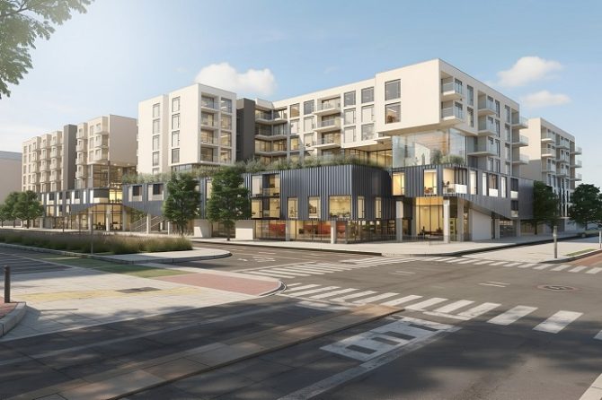
The massive project currently proposed for 4th and Arizona would be only about 20 percent smaller than Santa Monica Place (10.5 acres) squeezed onto a 2.5 acre site. Like Hines, it has generated enormous public engagement. It’s been controversial from the beginning — it’s size turned on its side is as big as a football field, it’s mix of uses (hotel, office, residential, retail) — and whether these uses benefit the public so as to BE on public land.
Now comes the release of the environmental impact report known as an EIR, the essential purpose of which was to study the traffic and other environmental impacts of the project in relation to project alternatives that would reduce those impacts.
Beforehand, the consultants got extensive comments from the public on what to study from individuals, neighborhood groups, the Santa Monica Coalition for a Livable City (SMCLC), and SMa.r.t. (Santa Monica Architects for a Responsible Tomorrow), as well as responsible agencies, like CalTrans. CalTrans worried about the project’s crippling effect on the 4th and 5th Street and Lincoln Boulevard freeway exits, and the California Incline. Turns out CalTrans was right to be concerned. The project would cripple the whole Downtown by generating anywhere from 4,000 – 5,000 daily car trips. And the non-park alternatives add anywhere from 3,000 to 5,800, more in one case because the consultant decided to study an alternative no one requested or deemed feasible – a huge residential alternative larger than the project with very little open space.

A site plan for 4th and Arizona project as drawn by Rob Goldman.
Here’s the troubling part: The EIR is just as deficient in its critical selection and analysis of project alternatives as the Hines EIR was. This EIR: 1) studies alternatives that are designed to be so similar in impacts to the project’s height, square footage, FAR/lot coverage and mix of uses that they aren’t really alternatives; 2) insufficiently analyzes the impacts of the various alternatives so that no reasonable comparisons or differentiations among them can be made; and 3) fails to include the SMa.r.t. “reduced project” alternative that includes a 75 percent open space town square that the Council directed be studied.
While the EIR did look at two “public park” scenarios, the remainder of the project alternatives include heavily built-out scenarios that generate impacts similar to the project, and what’s worse, impacts that can’t be mitigated to insignificant levels.
How did this happen? The Council told the developer at the “float up” to reduce 100,000 SF of the project’s 200,000 SF of office use and then transfer most of what was lost back into the project’s other uses – hotel, residential, retail. This direction from Council and the City Manager appears to have pre-determined the project before an EIR was even done. The EIR appears to have followed suit and impermissibly poses alternatives that are too similar to the project to significantly reduce the impacts from those of the project.
This, of course, defeats the whole purpose of an EIR — to study project alternatives which would have fewer negative environmental impacts, such as water, traffic, parking and infrastructure to make a reasonable and better choice. The Council has to have the vital information as to what the superior project IS in order to make a sound decision. Equally important – so does the public — to be able to advocate for it, and to be able to weigh it against what the Council approves in determining whether to support or challenge the decision made.

This is the most important project in our Downtown. Projects on public land necessitate the fullest range of environmental analysis as to impacts, disclosure as to impacts, and ways to lessen impacts, the greatest amount of accurate and complete information to facilitate public involvement, and ultimately a public vote. The City has already set that precedent for a public vote on the airport’s land uses – land that residents own. We expect no less here.
SMCLC and SMa.r.t call on the City to require the EIR to be revised and recirculated and to include alternatives that actually are of significantly reduced size and impacts to the project in addition to the overlooked SM.a.r.t “reduced project” proposal that should result in a reasonable project under CEQA that meets the City’s objectives under the Downtown Community Plan.
Stay tuned and we’ll update you on our next steps.
Guest Columnists are Diana Gordon, President of Santa Monica Coalition for a Livable City, and Mike Salazar, a local architect and preservationist. Both are longtime community activists. We thank Diana and Mike for their contribution this week.
By Diana Gordon J.D., and Mike Salazar, Architect for SMa.r.t.
(Santa Monica Architects for a Responsible Tomorrow)
Thane Roberts AIA, Architect, Robert H. Taylor AIA, Ron Goldman FAIA, Architect, Dan Jansenson, Architect, Building and Fire-Life Safety Commission, Samuel Tolkin Architect,
Phil Brock, Arts Commission. For previous articles see www.santamonicaarch.wordpress.com/writings.


