The Part One article showed Santa Monica’s permitting delay as self-inflicted; Part Two, that the bill has shed its exemptions, leading some to think Coastal Commission considers dropping its opposition. So our worries on AB 1740 lifting coastal review for city bluffs seemingly no longer exists. What protects the bluff now matters more, not less. To see why, start with what you can see for yourself on any clear afternoon.
The beach lies to you
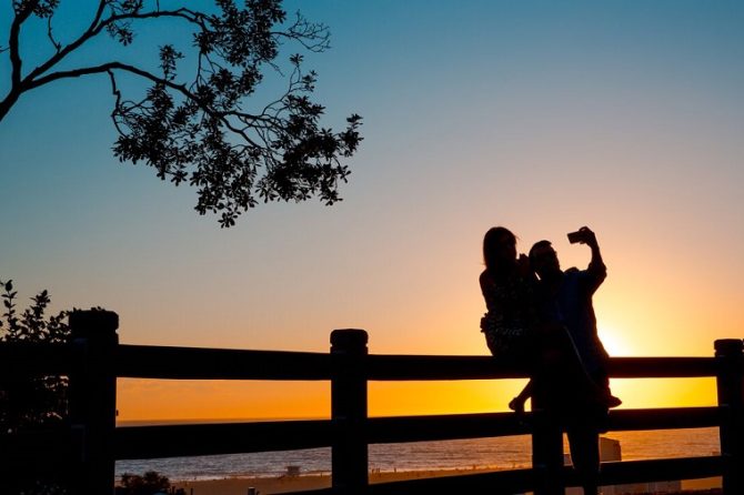
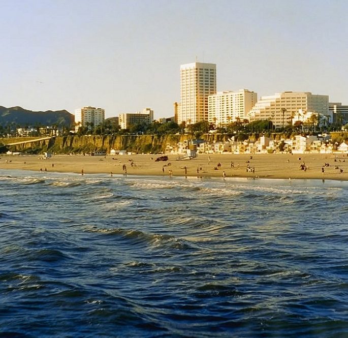
Walk down to the Santa Monica sand and look at the distance between the water and the bluffs. It feels enormous with a reassuring buffer between the ocean and the city above. That width is the most convincing illusion on the coast: the beach you are standing on is barely a lifetime old, and almost none of it is natural.
In its original state, the beach below the Palisades was a thin ribbon, perhaps seventy-five to a hundred feet wide, and at high tide and in winter storms, the waves ran right up to the foot of the bluffs. What widened it was engineering. A breakwater built off the Pier in the 1930s trapped an enormous load of sand, and for decades more was trucked and pumped in. But that breakwater was wrecked by storms in 1983, the rivers upstream now deliver only about half the sand they once did, and the sea is rising. The broad beach we enjoy as permanent is a temporary deposit, although it seems unlikely, it has already begun narrowing.
Where the line is actually drawn
This is why the state does something that surprises people: the line defined by the Coastal Commission’s authority near the bluffs is not measured from the water at all. It is measured from the top edge of the bluff — three hundred feet straight inland, and it stays there no matter how wide or narrow the beach below becomes.
Their rule lives in the state code’s dense language, but the idea is simple and durable. A cliff is a protected coastal bluff if its base was shaped by the sea within the last two hundred years, and the Santa Monica bluffs plainly qualify. They are wave-cut cliffs; the ocean carved them, and within the span the records cover, the surf reached their feet. The cliff edge is pinned, and the line is set three hundred feet inland, across Ocean Avenue, into the first row of blufftop lots, where it stays.
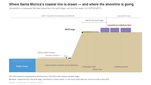
State lines all point to the same place
The state can locate that line three ways, either from the top of the bluff, from the inland edge of the beach, where a beach has vanished, or from the high-tide line itself. Today, those three sit far apart, because the beach is wide. The high-tide line lies out by the surf, while the beach’s established inland edge rests at the foot of the cliff. As a natural process, the beach will narrow, and the water will return to the base of the bluff. On that future day, the three lines will stand together at the cliff: two at its foot, one at its top, and because jurisdiction follows whichever measure reaches farthest inland, the line drawn from the top is the one that governs. The bluff is not merely where the line is today; it is where the other lines are heading. This addresses the coast we will have, not only the one we enjoy now.
Is our City Subtle?
Here is where the rewritten bill returns. AB 1740 no longer exempts anything at the bluff. Instead, it does something subtler: it puts Santa Monica on a deadline to finish its coastal plan by 2029, and the Commission on a deadline to certify it. More subtle is a hint that the state budget’s vote next week includes ‘trailer bill’ wording setting that until the LCP is certified, all housing projects are allowed. If true, that is pressure for an LCP with a choice as either an it’s approved, giving the city, not the Commission, the authority to issue the coastal permits for what gets built, or until then the developers are allowed to have their way. When finally approved, the Commission does not disappear; it steps back to hearing appeals about the narrow blufftop strip. The guardian is being moved from the front of the room to the back. And at that time, what rises at near cliff edge will be governed by that plan.
Which is why the having the plan is everything, and why speeding the bill’s approval is the worry. A coastal plan written against a clock leads to ask one question it most needs to answer well, and the one that rewards patience, not haste: how far from a retreating bluff, and designated lines may you build? What becomes of those buildings, and what happens to the public’s access below them, as the sea returns. If the plan’s standards for sea-level rise and bluff retreat are thin or vague, the city will be applying them to itself, on a coast that is moving, and the Commission will respond to the cases only when someone thinks to appeal.
There is also, as Part Two described, one statewide piece of the bill that touches access head-on, which is a new power to waive coastal permits for street projects that remove public parking. Near the shore, parking is access, and trading it away is the kind of call that used to require a public hearing. But the bluff’s long fate rests less on any single permit than on the plan now being hurried into being.
A fair hearing
It would be wrong to argue the city should not finish its plan. Finishing it is what citizens asked for; a completed, certified coastal plan is how local control is supposed to work, and how the delay finally ends. Forcing the city to act is not the problem. The problem would be a plan rushed past the single question a coast in motion cannot afford to get wrong. The task now is to make sure the plan produced treats the bluff as what it is: not the safe, far edge it looks like from today’s wide beach, but the coast’s actual future line controlling construction.
The bill has changed, but beach and bluff geology has not. Whether Santa Monica’s coast is protected for the next generation now turns less on AB 1740’s text than on the plan it hurries into being, and on whether that plan is written for the wide beach we stand on today, or the narrow one the sea will bring back. That choice is being made now, while the beach is still wide enough to make the danger easy to ignore.
____________________
Jack Hillbrand, Architect
For S.M.a.r.t.: Santa Monica Architects for a Responsible Tomorrow.
Jack Hillbrand AIA, Landmarks Commission Architect; Dan Jansenson, Architect, (former Building & Fire-Life Safety Commissioner); Robert H. Taylor, Architect AIA; Mario Fonda-Bonardi, Architect AIA (former Planning Commissioner); Sam Tolkin, Architect, (former Planning Commissioner); Michael Jolly ARE-CRE; Phil Brock (SM Mayor, ret.); Matt Hoefler, Architect NCARB; Heather Thomason, community organizer, Charles Andrews columnist. journalist, Bruce Leddy, Human Services Commissioner, and NOMA Co-Chair.