The prospect of more thunderstorms and heavy rain threatened the Southland today, a day after rain sent mud and debris into homes and severed roads, including Interstate 5 — the main artery between Los Angeles and California’s Central Valley.
Increasing the chance of heavy rainfall is the fact that any thunderstorm will move over the region slowly, and people living below slopes denuded by wildfire should take precautions, a National Weather Service statement said.
A flash flood watch will be in force from this afternoon until early evening in the Antelope Valley and mountain areas in Los Angeles, Ventura and Santa Barbara counties. A moist and unstable atmosphere will prevail in those areas, “bringing the threat of strong and locally severe thunderstorms,” said an NWS statement.
The statement noted that numerous road closures are in effect in the Antelope Valley and the mountains of Los Angeles County due to Thursday’s episodes of flash flooding and mud and debris flows.
“The threat of additional heavy rainfall … could impact clean-up operations and force additional road closures,” it warned. “There will be the potential for additional flash flooding as well as mud and debris flows across the watch area Friday afternoon into early evening.”
Along with the occasional precipitation, the NWS forecast cloudy skies today and more mild temperatures: 74 in San Clemente; 76 on Mount Wilson; 77 in Avalon; 78 in Newport Beach, Laguna Beach and at LAX; 79 in Mission Viejo; 80 in Long Beach; 81 in downtown L.A., Irvine and Anaheim; 82 in San Gabriel and Palmdale; 83 in Lancaster, Pasadena, Burbank, Saugus and Fullerton; 84 in Yorba Linda; and 85 in Woodland Hills.
Saturday’s temperatures were expected to be about the same, but no rain was in the forecast.
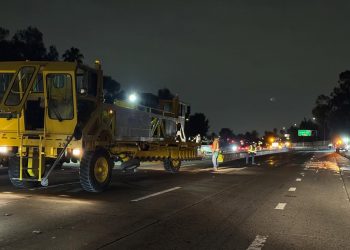
Showers and thunderstorms on Thursday produced heavy rain and hail in the area north of Castaic from the Golden State (5) Freeway to Lancaster and points east. About 2 1/2 inches of rain fell in the affected area, portions of which were covered with golf ball-sized hail. The Golden State (5) Freeway was blocked by rock and debris between Fort Tejon north of Gorman and Parker Road in the Castaic area and was expected to remain so until 2 p.m., according to the California Highway Patrol. Dozens of vehicles were trapped on the northbound side of the freeway.
Northbound traffic was being directed off the freeway three miles north of Santa Clarita at Parker Road and southbound traffic at Grapevine Road, according to the CHP.
Dozens of vehicles were trapped on the northbound side of the freeway. Patrick Chandler of Caltrans said Interstate 5 was choked by debris, mud and car-sized boulders and urged travelers to take a different route.
The CHP reported that state route 14, closed Thursday, re-opened early today, but state route 58, the Mojave-Barstow Highway, remained closed. Southbound motorists were being advised to take state Routes 41 or 166 to southbound U.S. Highway 101 to eastbound state Route 126.
CHP Officer Francisco Villalobos said Caltrans expects Interstate 5 to reopen at 2 p.m. Until then, northbound motorists were advised to exit the Golden State Freeway and take westbound state Route 126 to the 101 north.
Flooding was also reported by the National Weather Service near San Francisquito Canyon and Elizabeth Lake roads and a funnel cloud was spotted near Lake Hughes.
Rainfall records for Oct. 15 were set Thursday in Palmdale (0.94 of an inch) and Sandberg (0.65 of an inch), breaking the previous records of 0.04 of an inch and 0.15 of an inch, both set in 1935, according to the National Weather Service.
A record was also set at Fox Field in Lancaster, where 0.65 of an inch fell, breaking the previous record of a trace amount set in 2005.
Several homes were engulfed in mud in the Elizabeth Lake area and vehicles were trapped in mud flows on Elizabeth Lake Road in the Lake Hughes area.
Aerial video showed a mobile home on its side, apparently swept off a road by a mud flow. Flood and mud also damaged homes in Palmdale.