August 18, 2025 Breaking News, Latest News, and Videos

Does Your Neighborhood Face the Hazard of Wildfires? New State Maps Reveal the Danger Zones

Here’s How to Check Your Area’s Rating and What It Means for Homeowners

For the first time in 10 years, the California Department of Forestry and Fire Protection (Cal Fire) has updated its Fire Hazard Severity Zone maps, revealing heightened wildfire risks across Los Angeles. The newly released maps assess the fire danger levels in areas where local fire departments manage wildfires, offering a clearer picture of which neighborhoods face the greatest threat.

Residents can check their neighborhood’s fire hazard rating by entering their address into Cal Fire’s interactive map on its website. The updated maps are part of a statewide effort to reassess fire risks in light of recent destructive wildfires and climate-related changes.

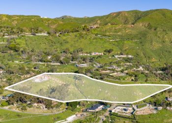
The highest hazard zones now include areas north and south of the Santa Monica Mountains, as well as both sides of the 405 Freeway through the Sepulveda Pass. These regions, already prone to wildfires, have seen increased risk due to factors such as persistent drought, dry vegetation, and strong seasonal winds.

While the latest updates focus on areas under local fire department jurisdiction, Cal Fire previously remapped state-controlled areas in 2022, also showing an increase in high-risk zones. Federal lands, which account for nearly 45% of California’s total land area, are not included in either set of maps.

The Fire Hazard Severity Zone maps were developed in response to California’s history of devastating wildfires. Under the California Public Resources Code 4201-4204, mapping of fire hazards is mandated statewide, covering all State Responsibility Areas (SRA).

To assess wildfire hazard levels, Cal Fire uses a science-based model that evaluates:

  • Fire history
  • Existing and potential fuel sources (natural vegetation)
  • Predicted flame length and blowing embers
  • Terrain and slope
  • Typical fire weather patterns in the area

The maps categorize three levels of fire hazard in the State Responsibility Areas:

  1. Moderate
  2. High
  3. Very High

Cal Fire emphasizes that the maps measure “hazard,” not “risk.” This distinction is similar to flood zone maps, which predict the probability of flooding but do not account for mitigation efforts such as levees or drainage systems.

  • Hazard” refers to the likelihood of wildfire occurrence based on physical conditions over a 30 to 50-year period, without considering recent mitigation efforts such as fuel reduction or home hardening.
  • “Risk” accounts for factors that could reduce wildfire damage, such as defensible space, ignition-resistant construction, and wildfire prevention programs.

With these updated maps, Los Angeles residents in high-risk areas should take extra precautions, including:

  • Creating and maintaining defensible space around homes
  • Following fire-resistant landscaping guidelines
  • Strengthening homes with ignition-resistant materials
  • Staying informed on evacuation routes and emergency preparedness plans

The new fire hazard maps are expected to influence building codes, insurance rates, and local emergency planning efforts. Homeowners, developers, and local officials are encouraged to review the maps to better understand fire risks and prepare accordingly.


<>Related Posts

Workers’ Compensation Defense Law Firm Opens Santa Monica Office

August 16, 2025

August 16, 2025

The Santa Monica office is part of Gilson Daub’s national expansion, which includes eight new offices opened across the U.S....

$25 Million Campaign Launched to Restore and Expand Palisades-Malibu YMCA

August 16, 2025

August 16, 2025

Community Leaders Launch $25 Million Campaign With $10M County Pledge Officials and community leaders gathered Thursday to break ground on...

LAPD Seeks Additional Victims in Venice, Santa Monica Sexual Assault Case

August 16, 2025

August 16, 2025

Detectives have identified three victims but believe others may exist Detectives from the Los Angeles Police Department’s Operations West Bureau,...

Jeni’s Splendid Ice Cream Debuts  All-Black Ice Cream in Collaboration With Artist Cj Hendry

August 15, 2025

August 15, 2025

Limited-Edition Flavor Opaque and All Black Cones Launch on Aug. 14 Jeni’s Splendid Ice Creams is stripping away the usual...

County Jail System Achieves Compliance Milestone in Inmate Processing

August 15, 2025

August 15, 2025

Key improvements include a new Shared Intake Management System using wristband scanner technology to track and expedite inmate processing Los...

Santa Monica Pier to Honor Local Legends at Inaugural PIERfect Benefit Fundraiser

August 15, 2025

August 15, 2025

The event marks the debut of the Santa Monica Pier Awards, and will recognize an original Pier Corporation board member...

Metro Honors Nipsey Hussle with Limited-Edition TAP Cards, Temporary Station Rename

August 15, 2025

August 15, 2025

The initiative honors Hussle, born Ermias Asghedom, a South Los Angeles native known for his music, entrepreneurship, and community activism...

(Video) DTSM Inc. Holds First Meeting Since Multi-Member Ousting by City Council

August 15, 2025

August 15, 2025

The meeting convened as ousted members threatened legal action against the council DTSM Inc. Holds First Meeting Since Multi-Member Ousting...

Film Review: My Mother’s Wedding

August 14, 2025

August 14, 2025

FILM REVIEWMY MOTHER’S WEDDINGRated R95 MinutesReleased August 8th   Actress Kristin Scott Thomas began working on this highly personal project about...

Concert in the Courtyard: Israeli Band The Peatot Brings High-Energy Sound to Adat Shalom Synagogue

August 14, 2025

August 14, 2025

Event in Westwood Will Feature Live Music, Food, and Family-Friendly Community Celebration Adat Shalom Synagogue will host a summer evening...

THIS SUNDAY: CicLAvia to Turn Venice Streets into Car-Free Park

August 14, 2025

August 14, 2025

The event will spotlight Venice’s iconic Boardwalk, Muscle Beach, picturesque Venice Canals, and trendy Abbot Kinney Boulevard along the 6.75-mile...

Ousted Downtown Santa Monica Board Members Threaten Legal Action Against City Council

August 14, 2025

August 14, 2025

Attorneys for Board Members Claim the City Illegally Removed Members Without Cause Attorneys representing two members of the Downtown Santa...

Mr. Charlie’s Brings Plant-Based Fast Food to 26th Street With Grand Opening Giveaway

August 13, 2025

August 13, 2025

Plant-Based Favorite Opens Brentwood Adjacent Spot With Opening Day Perks Mr. Charlie’s, the fast-growing plant-based fast-food chain known for its...

La La Land Kind Cafe Unveils First Kids’ Menu with Disney’s Mickey & Friends

August 13, 2025

August 13, 2025

Limited-Edition Drinks, Mini Bites, and Even Treats for Pets, Arrive Aug. 19 La La Land Kind Cafe will debut its...

ROLLD Sushi to Bring Australian-Style Hand Rolls to Montana Avenue

August 13, 2025

August 13, 2025

All items are gluten-free and available with white or brown rice, catering to diverse dietary preferences A fresh take on...