Executive assistant to the President of Santa Monica College Don Girard told the Planning Commission on February 1 that the College’s growth rate will slow over the next 10 years.In the last 12 years, the campus’s “land-based growth” has been about 33 percent in total or about 2.7 percent a year. According to Girard, the college now anticipates that “land-based growth” will run about 14 percent, or about 1.35 percent a year in the next ten years, as “current sites and planned improvements are sufficient to meet future needs…[and] future online education is projected to double.” Girard also pointed out that SMC has applied adaptive reuse principles when developing satellite locations, as when it converted Gemological Institute into the Arts and Entertainment Academy, and is using former Leat Siegler offices on its Bundy campus, the old Madison School, and U.S. Army structures at its Airport Arts campus. SMC’s main campus build-out will only grow by 12 percent, Girard said, “due to new financial resources available to move programs to satellite locations.” He went on to say that other changes on the main campus have made it pedestrian-only and a “new campus quad will add a new two-acre open space for public benefit.” Girard also discussed traffic and parking issues as they relate to SMC and the surrounding neighborhoods. A door-to-door survey of 4,812 registered voters city-wide conducted between April and October, 2005, found the people polled believe the top five primary causes of local traffic and parking problems are excess local development (43 percent), regional traffic growth (36 percent), inadequate resident parking (34 percent), poor planning of streets and signals (24 percent) and an inadequate transit system (21 percent).However, when the causes of local traffic were broken down by neighborhoods adjacent to the college, the results changed. In the Pico Neighborhood the top five causes were inadequate resident parking (48 percent), excess local development (41percent), regional traffic growth (29 percent), SMC traffic (21 percent) and poor planning of streets and signals (18 percent). Sunset Park residents also saw things differently. They named the five primary causes of traffic as excess local development (39 percent), regional traffic growth (35 percent), Santa Monica College traffic (24 percent), inadequate resident parking (23 percent) and poor planning of streets and signals (21 percent).The survey also asked residents whether SMC should increase on-campus parking. Citywide, 76 percent said yes. In the Pico Neighborhood 77 percent said yes, and in Sunset Park, 67 percent said yes. Pollsters also asked whether SMC should reduce student enrollment. Citywide 89 percent said no, 90 percent in the Pico Neighborhood said no, and in Sunset Park 80 percent said no.Girard described the steps SMC has taken to reduce neighborhood traffic. They included “restarting the shuttle parking program (1994), closing the surface parking lot off of Pearl Street (1994) and relocating admissions to Pico Boulevard (1998). The changes have, he said, “resulted in a reduction of street traffic of between 10 and 15 percent in Sunset Park.In addition, the College has acted to reduce car trips by a “calendar change (classes that met three times a week now meet twice a week), shifting of classes to afternoons and Fridays, conversion of admissions to 100 percent online and the start-up and expansion of online education.”Girard predicted that over the next ten years the College “will reach parking self sufficiency.” To achieve it, SMC will propose “a restoration of parking on the Main Campus to pre-earthquake levels and to provide short-term parking for community use of athletic facilities” as well as a “replacement shuttle.”Aiming to “better manage student outbound traffic,” SMC will propose signal improvements for Pico Boulevard, and is exploring sources for a program like the “Go-Bruin” program for SMC students, in which students would ride the Big Blue Bus at no charge with the College picking up the tab.Girard’s report to the Commission will be used by it in its continuing work on the City’s revision of the land use and circulation elements of its General Plan. The land use element delineates the distribution of different types of buildings (housing, business, industry, open space, etc.) while the circulation element sets out the location of existing and proposed roads, highways, and other modes of transportation. The zoning ordinance translates the land use element’s goals and objectives into standards and procedures. They were last updated in 1984.
You might be interested in …
Obama Inspired Day Of Service at Ballona:
National Service Day: The Ballona Institute hosted a day of service for Ballona Wetlands Preservation in conjunction with President-elect Barack Obama’s call to community service on Martin Luther King Day, Monday, January 13. Andrew Sielberger, […]

Raised Rents for Outdoor Restaurant Patios:
Restaurants across the city may see a spike in rent thanks to a proposal to increase costs for outdoor patio spaces that encroaches on the public sidewalk. Currently outdoor patio space rates for businesses are […]
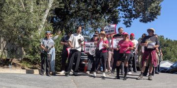
The first protest at René Redzepi’s Noma pop-up at the Paramour Estate (Video)
The protest was organized by Jason Ignacio White and One Fair Wage after the owner and chef of Noma, René...
Read more


Film Review: Oscars Landscape 2026
My Oscar choices and predictions. The 98th Academy Awards, Sunday, March 15th at 4:00 PM, on ABC, and streaming on...
Read more